GOVPH | The Official Website of Barangay 17, Cagayan de Oro City
Discover the Distinctive Essence of Barangay 17 in Cagayan de Oro City
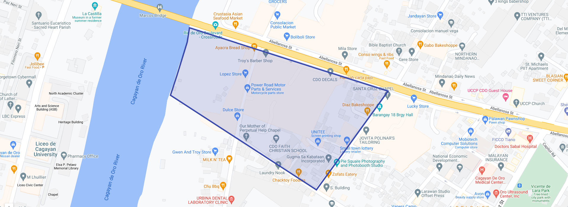
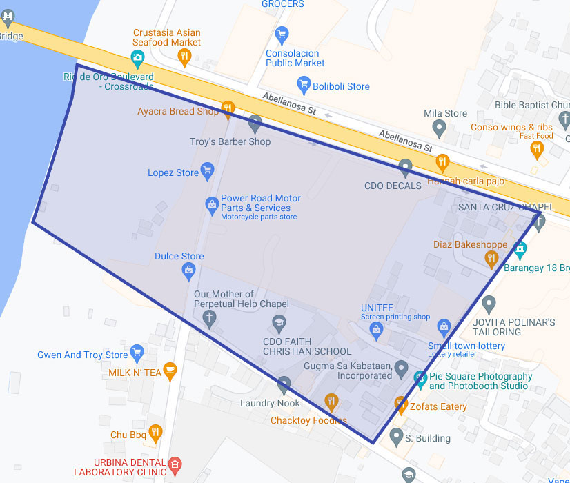
Barangay 17, designated as an urban barangay in accordance with Section I of Ordinance No. 1644 and guided by the provisions outlined in Ordinance No. 73, series of 1973, strategically lies at the intersection of Burgos Street. The eastern boundary is marked by Magsaysay Street, the southern border by Marcelo H. del Pilar Street, and the western demarcation by the Cagayan de Oro River. Located at approximately 8.487226, 124.643237 in Mindanao, the barangay enjoys an elevation of 5.1 meters or 16.7 feet above mean sea level at these coordinates. Covering a land area of 77,070 square meters, Barangay 17 is subdivided into four (4) distinct zones: Zone 1, Zone 2, Zone 3, and Zone 4.
Unveiling the SMART Evolution of Barangay 17
Formerly recognized as Poblacion, Barangay 17 stands as a bustling community in the heart of Cagayan de Oro City, making significant contributions to the dynamic urban landscape. With a population of 2,058 residents, representing 0.28% of the total population of Cagayan de Oro according to the 2020 Census, Barangay 17 is embracing a SMART future.
Strategic Positioning in the Vibrant East District
Situated in the 2nd district of Cagayan de Oro, Barangay 17 aspires to be a SMART BARANGAY, holding a distinctive position among the 56 barangays in the East district. This dynamic community actively contributes to the rich political tapestry of Cagayan de Oro and is poised for comprehensive urban development.
Urban Tapestry: Infrastructures, Enterprises, and Residential Zones
Barangay 17 stands out among the 57 urbanized barangays in Cagayan de Oro, boasting contemporary infrastructure, thriving commercial enterprises, and well-defined residential zones. The leadership, led by Barangay Captain Anthony A. Atterviry III, plays a pivotal role in steering the barangay towards progress and prosperity through an unwavering commitment to community service and resident welfare.
Geographical Distinction and Cultural Landscape
Cagayan de Oro, with 80 politically subdivided barangays grouped into two congressional districts, features a diverse cultural landscape. The Cagayan de Oro River, serving as the natural boundary between the 1st district (West) and the 2nd district (East), adds a unique charm to the city's geographical makeup.
Barangay 17's Crucial Role in City Growth
In the grand scheme of Cagayan de Oro's development, Barangay 17 plays a vital role as an urbanized barangay, embodying a blend of residential, commercial, and community spaces that mirrors the dynamic spirit of Cagayan de Oro City as a whole. The barangay serves as a testament to the city's growth and development, contributing to its ever-evolving urban landscape.
Explore the vibrant streets, witness thriving community life, and delve into the unique charm of Barangay 17 - a cornerstone in the dynamic growth of Cagayan de Oro City.
Barangay 17 CDO | Summary Data |
|---|---|
Type | Barangay |
City | Cagayan de Oro City |
Region | Northern Mindanao (Region X) |
Island group | Mindanao |
Postal code | 9000 |
Population (2020) | 2,058 |
Coordinates | 8.487226, 124.643237 |
Estimated elevation above sea level | 5.1 meters (16.7 feet) |
Mission and Vision
Mission
A healthy and disciplined constituents; living in a well-equipped, clean, progressive, and secured community through effective and dedicated servants.
Vision
To address the genuine needs and well-being of Barangay 17 constituents through focused and responsive services.
Barangay 17 MAP
Charting Progress, Connecting Community: Navigating the Barangay 17 Master Action Plan (MAP)